Summary
Potential
New high-grade gold discoveries, the Grub Line property is bordering the Queensway North project operated by New Found Gold Corp.
Geology
Mafic-ultramafic plutonic rocks belonging to Gander River Ultrabasic Belt (GRUB) and volcanic sequences unconformably overlying it to the west
Relatively Underexplored
Recent discoveries lead to comparisons of mineralization style at Queensway to a high-grade gold deposit in Australia
Area
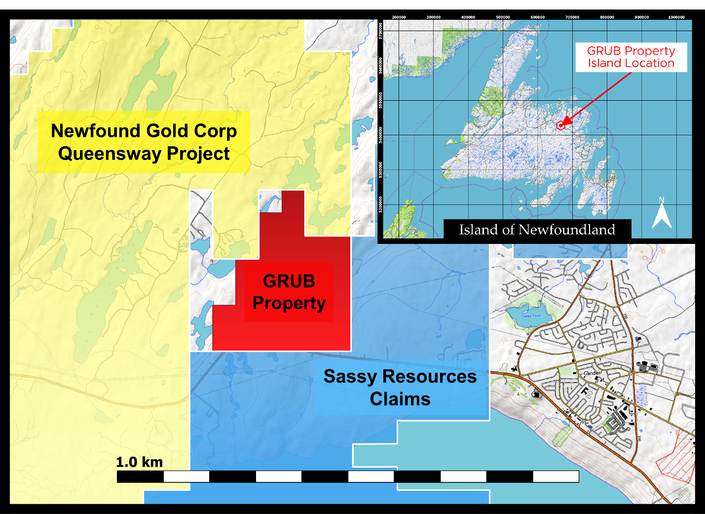
The property lies along the Trans Canada highway, 3.5 km west of the town of Gander in north-central Newfoundland
Introduction
Newfoundland has a relatively long mining and forestry history. Mineral exploration companies and the Government in NL have adopted proactive strategies to attract, recruit, diversify, and retain skilled workers associated with, and committed to, the mining industry.
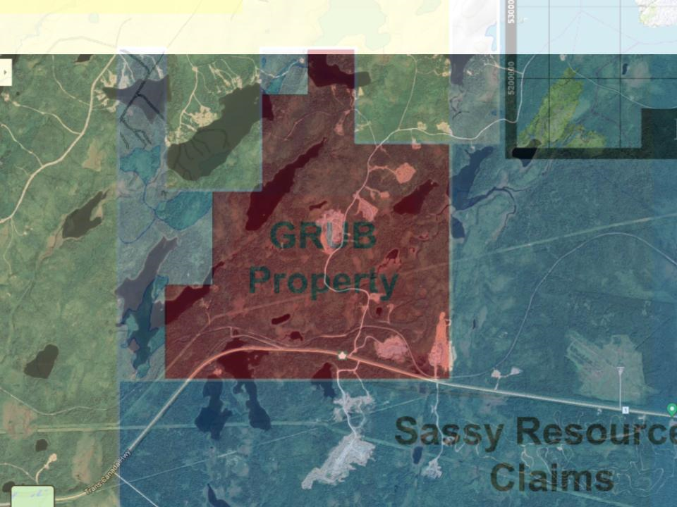
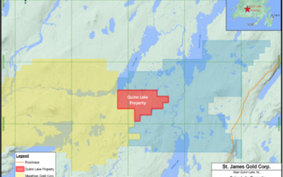
The Grub Line property is located 3.5 kilometers west of the town of Gander, NL, entirely within NTS sheet 2D/15 (Figure 1). Access to the property is excellent. The Trans Canada highway crosses the southern portion of the property, while a network of rough-track roads leads to many of the exploration sites.
The land underlying the project area is vested in the Crown (Crown Land) with no restricted access. In Newfoundland and Labrador, the right to explore for minerals is obtained through a map staked licence which is issued for renewable terms of five years to a total of 30 years.
The climate is blended maritime-humid continental, with pleasant summers, a cool, wet, spring and autumn, and snowy, often windy, winters. A typical spring/summer exploration season is from May through to the end of November. Exploration, particularly geophysics and drilling can be easily done through the winter months.
The nearest communities include: Gander, a town of approximately 10,000, located 3.5 km to the east on the Trans-Canada Highway, which has an international airport and most amenities required for exploration including labour, equipment, accommodation and supplies.
Newfoundland has a relatively long mining and forestry history. Mineral exploration companies and the Government in NL have adopted proactive strategies to attract, recruit, diversify, and retain skilled workers associated with, and committed to, the mining industry.
from 2004 trenching program on adjacent Queensway Project of New Found Gold Corp.
over 19 metres during 2019 drilling at Keats Zone on adjacent Queensway Project of New Found Gold Corp.
At the Grub Line Property, Dustin Keats, Planet X Exploration Services Ltd.
Exploration is underway at the recently optioned Grub Line gold property in Newfoundland, Canada, at a prospective location along the Gander River Ultramafic Belt with project field operator, local exploration service company Planet X Exploration Services Ltd.
Regional Geology
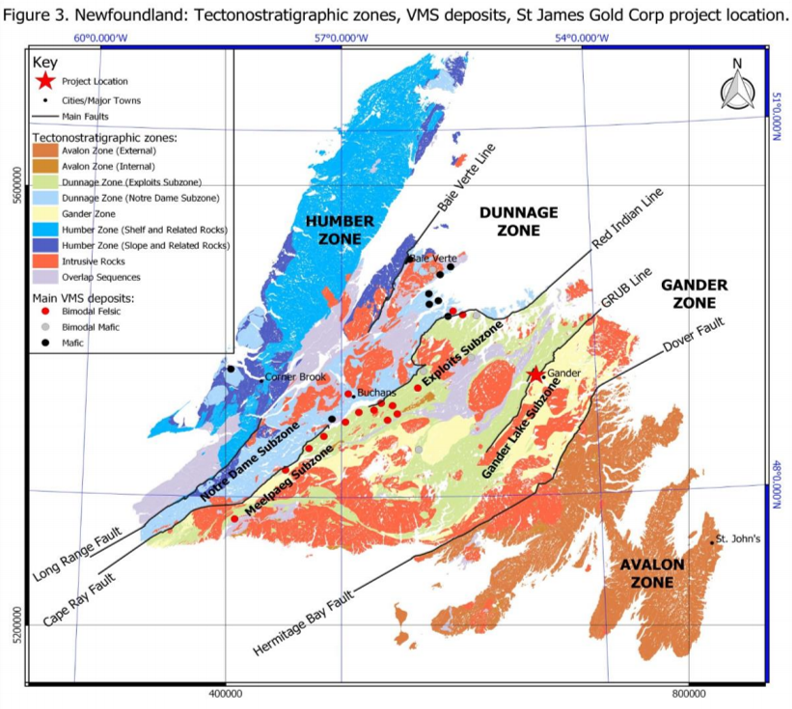
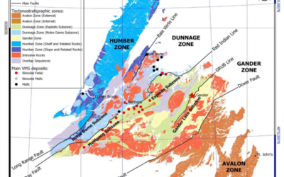
The Island of Newfoundland forms the easternmost part of Appalachian Orogen and is divisible into four main tectonic zones (Figure 3). From west to east are the Humber Zone, which represents the ancient, Laurentian continental margin, the Dunnage Zone, which represents a series of Cambrian to Ordovician arcs and back-arc basin assemblages, the Gander Zone, which is dominated by metasedimentary rocks sourced from the Gondwanan margin, and the Avalon Zone, which contains Neoproterozoic rocks overlain by Cambrian-Ordovician sedimentary rocks that have Gondwanan affinities. The Dunnage Zone is further subdivided into the Notre Dame Subzone and the Exploits Subzone.
The Grub Line licence area lies in the Exploits subzone near the eastern edge of the Dunnage Zone in units of the Davidsville Group, a NNE-trending belt of mainly slate, interbedded with thick, coarse-grained greywacke units and intruded by linear, mafic to ultramafic, dykes that trend NNE and NNW and are thought to dip subvertically. They represent relics of an ophiolitic complex thrusted upon Middle Cambrian to Lower Ordovician arenites and shales of the Gander Zone. This tectonic margin forms a continental suture that is traceable through Newfoundland and into Ireland and Great Britain.
Dunnage Zone consists of various Cambro-Ordovician island arc and ophiolitic terranes overlain by turbiditic sedimentary cover and locally by late-orogenic (Late Ordovician– Silurian) molasse sequences formed during Taconid and Penobscot orogenies. The Dunnage Zone was subjected to later deformation during the Silurian Salinic orogeny and was intruded by Devonian granitoid plutons, and mafic stocks and dykes. Gold mineralization within the Dunnage Zone occurred coincident with late syn- to post Salinic orogenic events and is typically spatially related to major structural features and proximal to, or hosted in, intrusive bodies.
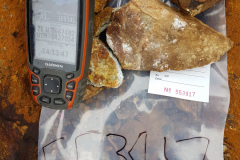
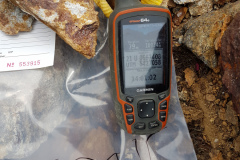
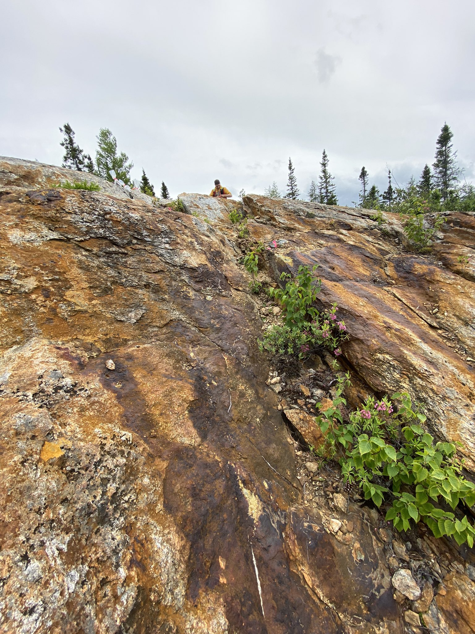
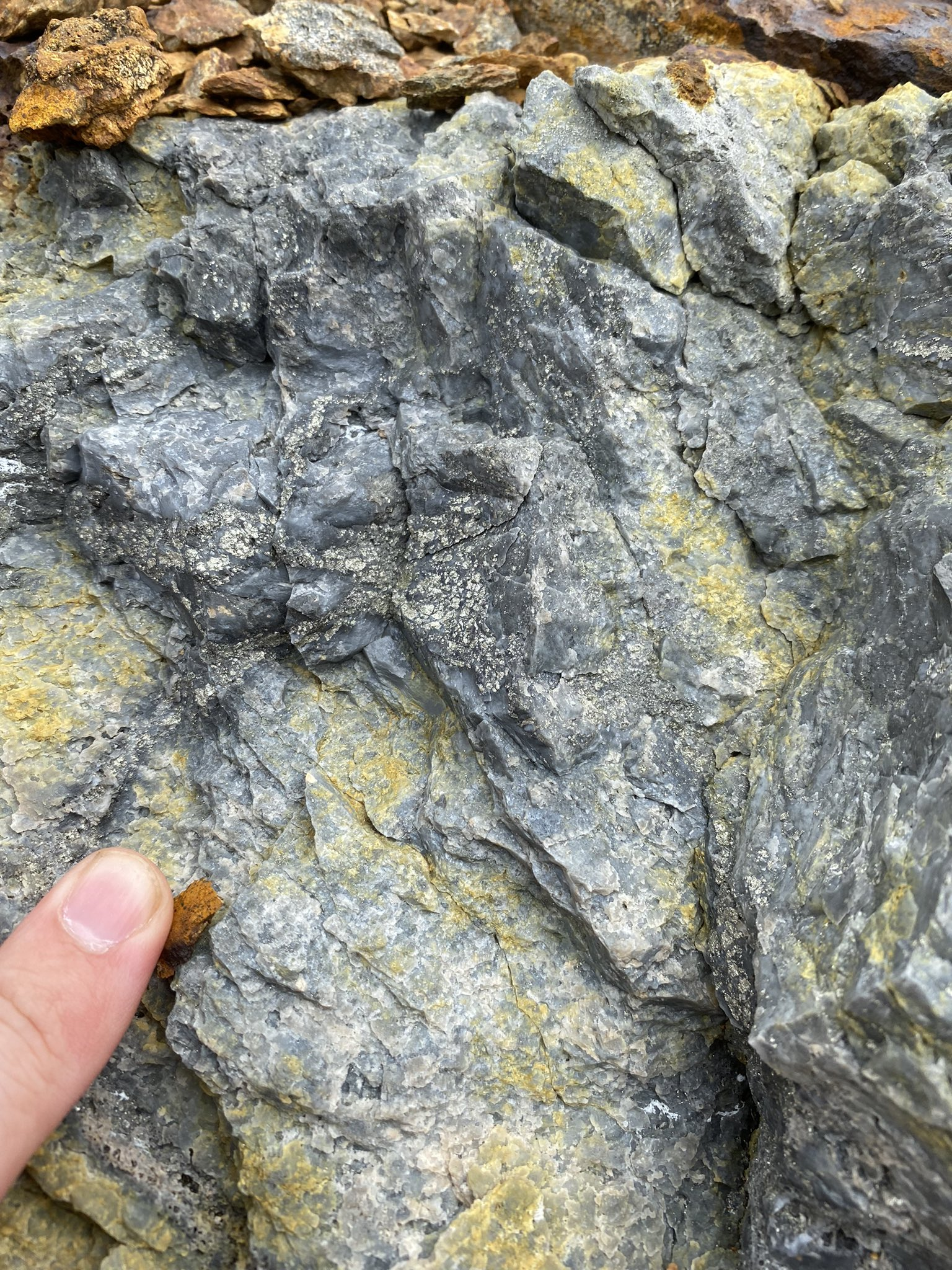
The Grub Line Property covers a package of the Gander River complex of rocks. See photographs below. This package is comprised of felsic volcanics, mafic volcanics, ultramafic rocks, and gabbro intrusions. Intense hydrothermal activity has altered the rocks and strong sericite, calcite, chlorite & talc-carbonate alteration has been observed in host rocks and quartz veins throughout the property. There can be rich endowments of sulphide minerals in these geological environments. Listwanites or carbonatized ultramafics that commonly occur in the gander river complex of rocks have been identified as potentially gold-bearing.
The spatial relationship of gold mineralization to faults zones with carbonatized ultramafics/listwanites suggests a comparison to the Mother Lode Belt in California. Similar listwanitic gold quartz veins have formed economic deposits in the metamorphic belts of California and the Juneau Gold belt in Alaska. The program manager, Planet X Exploration Services Ltd. is using a general deposit model where the carbonatization of ultramafic rocks and the development of gold veins in and above thrusts, reverse and normal faults act as a guide for exploration along the Grub Line Property.
The initial exploration program at the Grub Line Property consists of regional prospecting and ground-truthing historical prospects located within the 725-hectare project area. The Grub Line Property is believed to be an important aspect of the major structural corridors related to both the Gander Gold belt and the Newfound Gold Corporation – “Keats zone” hosting bonanza high grade gold mineralization. The Grub Line Property hosts several well-mineralized zones and is located only 8 km east of the Newfound Gold Corp.’s “Keats Discovery”, and 3 km west of the Town of Gander, on the island of Newfoundland, Canada.
History
Gold mineralization was first noted in quartz veins in “silky blueish slates” on the Gander River by Alexander Murray and James Howley in 1876. No attention was paid to this discovery until the 1970’s, when Frank Blackwood, while mapping for the provincial government, discovered Au/As mineralization along the Gander River Ultrabasic Belt (GRUB) Line near Jonathan’s Pond.
Between the 1950’s and the 1980’s, the exploration work was focused on industrial minerals, such as chromite, magnesite and asbestos in the Gander River Ultramafic Complex. Some reconnaissance base metal prospecting was also conducted and continued after discoveries of copper, zinc and tungsten in the area.
To the west from Grub Line area, in 1987 and 1988, Noranda Exploration conducted
reconnaissance soil and till sampling at 500 metre intervals along three widely spaced lines across the H Pond and Pocket Pond area. Numerous highly anomalous gold values were obtained (up to 975 ppb Au) in the H Pond area, straddling H Pond Brook situated 4 km west of Grub Line project area. Only one sample line crossed the current Grub Line Property area with four samples taken. One till sample sample produced anomalous value of 35 ppb gold.
In1975, International Mogul Mines completed 778 meters of diamond drilling in the area where Trans Canada Highway crosses Gander River Ultramafic Belt. Five of the seven holes drilled (583.5 meters) are located within the area covered by Grub Line licence. Short intersections of low-grade zinc mineralization were reported during re-sampling of the core in 1985.
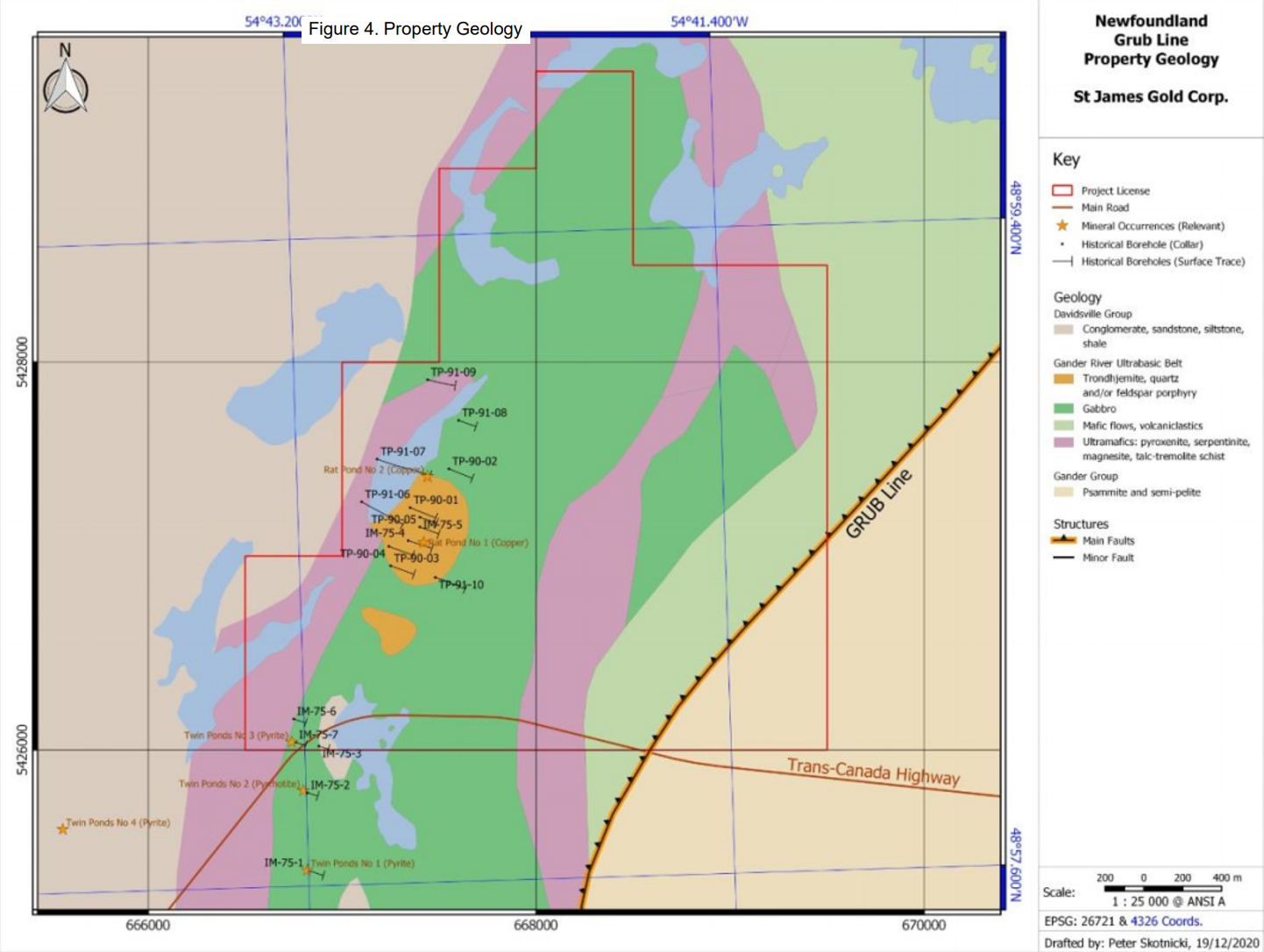
In 1987, Falconbridge completed regional till sampling and prospecting over the area. Several anomalous values were reported in heavy mineral concentrates of till, ranging up to 539 ppb Au. Subsequently, stripping in the Twin Ponds area led to discovery of zinc and copper mineralization, but the source of gold in the till samples was not explained (Figure 4).
In 1990, Falconbridge performed ground geophysical surveys and followed with 989.68 meters of diamond drilling and trenching targeting VMS-style base metal mineralization. In 1991, Falconbridge completed additional 1514.58 m of diamond drilling. The results are listed in Table 2. More drilling was recommended but there are no reports of any significant exploration conducted since.
In 1990, Gander River Minerals Inc. carried out geological reconnaissance on the Joe Batt’s Brook property to the west of Grub Line project area. One anomalous soil area and an anomalous stream silt area (up to 1020 ppb Au) were identified. No bedrock source was found.
During 1999 and 2000, Larry and Roland Quinlan staked and prospected two licences that included the Joe Batt’s Pond area. Up to 20.5 g/t Au was reported from quartz float with heavy arsenopyrite mineralization. Two soil samples northeast of the mineralized float returned 487 and 1489 ppb Au.
Rubicon Minerals Corporation began acquiring interest in the property area in 2001. In June 2002, Rubicon prospectors Suley and Al Keats discovered visible gold in quartz float near the shore of Gander Lake, and in stream beds near the Lachlan prospect. The current Grub Line licence area was the eastern most part of Rubicon’s land holdings totaling 9,075 ha. However, all work was focused along Joe Batt’s Pond fault situated 4 km west from the licence area.
During the summer of 2003, Rubicon located abundant quartz float over a 3 km trend between H Pond and Pocket Ponds, including a major, 800 m long, quartz boulder train exposed along H Pond Brook. One sample of quartz vein float from along the brook assayed 159 g/t Au, while 19 of 53 samples averaged better than 3 g/t Au. Visible gold was reported from seven of these samples. The abundance, size, and angularity of the quartz float suggested a very local bedrock source.
Trenching carried out in January 2004 exposed a mineralized quartz vein system at Pocket Ponds. Grab samples returned up to 22.6 g/t Au. Subsequent diamond drilling by Rubicon in August and September 2004 discovered the H Pond Prospect along H Pond Brook and the Pocket Ponds Prospect near East Pocket Pond.
In 2005, Rubicon continued exploration of and defined two structural gold trends in Joe Batts Pond area. One over 4000 meters of strike length at 035° and second over 1,500 meters striking 100°.
In 2007-2008, Paragon Minerals took 2,800 samples of B soil horizon to define more targets for trenching and drilling along Joe Batts Pond trend. Over ten samples had values greater than 100 ppb with a maximum value of 2125 ppb Au collected south of the eastern leg of H Pond.
Since the discovery of JBP gold trend, more exploration drilling was conducted with subsequent map staking and consolidation of mineral licences by major players in the area. Major discoveries were made along Appleton fault to the west of JBP fault trend.
The large land holdings bordering Grub Line Property to the west are Queensway North project operated by New Found Gold Corp. At Keats zone, situated 7 km west from Grub Line, a discovery hole in 2019 intersected 92.96 g/t gold over 19 meters.
Historic information on the projects bordering the Grub Line project, particularly in regard to historical exploration, and government geological work provides an indication of the exploration potential of the property but may not be representative of expected results.
Property Geology
Mafic-felsic sequence lies at the base of the felsic horizon. All units in the area are interpreted to dip 30 deg to the west. The felsic unit is greater than 600 meter in length and is intruded by gabbro towards the east.
The felsic volcanic rocks consist of massive rhyolite, ash to lapilli tuff and agglomerate. Mafic rocks are pale to medium green gray massive to pillowed basalts with common calcite veining.
The western part is underlain by sediments, which are interbedded with crystal tuffs and ultramafic rocks. Sedimentary rocks consist of graphitic black shales with minor greywacke, sandstone and argillite.
Quaternary mapping by NL government researchers in 1986 indicates that the Gander River area has been subjected to two regimes of glacial flow, the first towards the east and the second toward the north. There was an earlier flow directed to the east (080º to 100º deg) and a later northward flow (000 to 030º deg) towards the coast (Gander and Loon bays).
Landforms are normally of low relief, and glacial deposition features are limited to either a few scattered occurrences of lineated (fluted) till forms that are subparallel to the latest direction glacial transport, or ribbed-moraine till deposits that are transverse to the latest flow directions.
Mineralization and Alteration
Felsic tuffs and agglomerates are variably sericite and chlorite altered and exhibit stringer-controlled mineralization consisting of pyrite and minor sphalerite and chalcopyrite mineralization. Locally mineralization contains massive ore-grade sulphide fragments in dark chloritic matrix. These characteristics are indicative of VMS-type environment.
Core logging revealed that felsic pyroclastic units – agglomerates and tuffs – exhibit widespread alteration with sulphide stringers occurring in most chloritized and sericitized sections. Disseminated pyrite and minor sphalerite and chalcopyrite occur throughout the felsic sequence.
Hole TP-90-01
Hole TP-90-02
Hole TP-90-03
Holes TP-90-04 and TP-90-05
lithogstratigraphic marker horizon for VMS mineralization in the area.
Hole TP-91-06
Hole TP-91-07
Hole TP-91-08
Hole TP-91-09
Hole TP-91-10
Deposit Types
Geological setting of Gander River and Gander Lake areas is favorable to volcanogenic massive sulphide mineralization and orogenic-style gold mineralization.
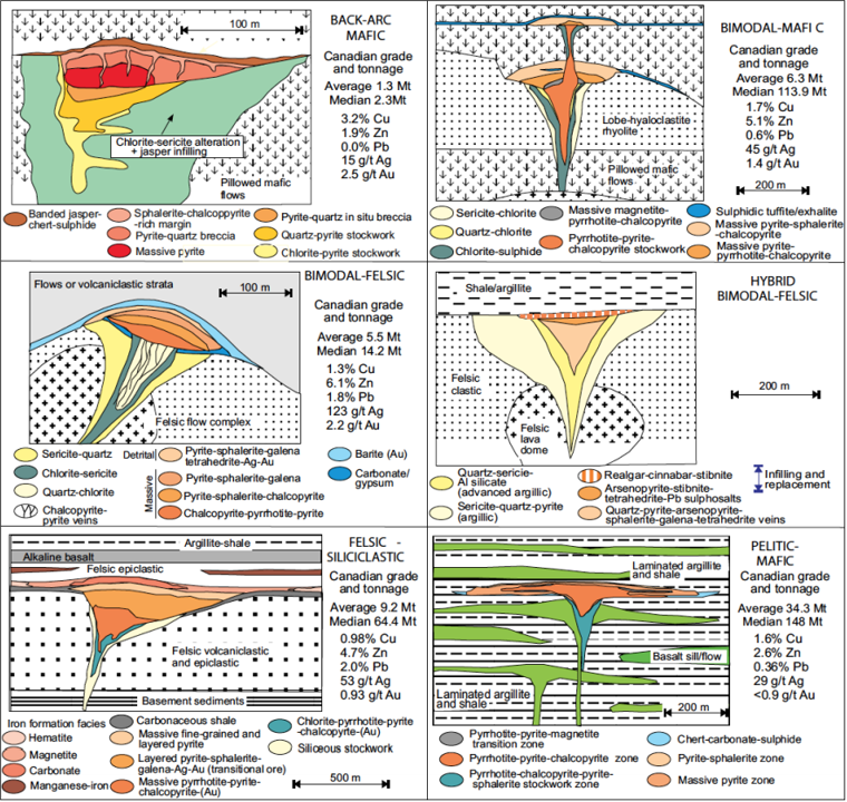
Volcanogenic massive sulphide (VMS) deposits form as a result of the syngenetic exhalation of metalliferous hydrothermal fluids upon or near the sea floor. The rocks of Gander River Ultramafic Complex intrude Davidsville Group sediments within the Property. This setting appears to be prospective for bimodal mafic subtype of VMS deposits.
The bi-modal mafic felsic subtype are hosted in belts that are mafic dominated, but where the mineralization is hosted by felsic rocks. Often, these environments are primitive arc terranes. They are often polymetallic, but with abundant Zn and Cu. The Newfoundland Appalachians contains over 40 VMS deposits, each of which has >100 000 tonnes of massive sulphide, based on historical geological resources. These deposits are hosted by rocks of the Dunnage Zone or its obducted, ophiolitic equivalents in the Humber Zone. Bi-modal VMS deposits that are common to the Noranda and Flin Flon districts, and Newfoundland Appalachian examples include deposits such as Ming, Rambler, and Point Leamington (Figure 3). However there are no known deposits of this type located in the eastern part of Dunnage Zone.
The gold mineralization in the district is epigenetic and structurally-controlled and often associated with splays or secondary structures off regional-scale fault zones. It can occur in a wide range of rock types, but iron-rich mafic rocks are a more prolific host. As typical of orogenic gold mineralization elsewhere, the gold comprises both vein-hosted and altered wall-rock styles of mineralization. In vein hosted occurrences the gold occurs either as free-gold or in association with pyrite, arsenopyrite or base metals. The veins are typical of shear-zone hosted gold mineralization and comprise both shear and extension-type veining.
Gold in the Queensway project, immediately west of the Grub Line Property boundary, is associated with quartz veins and alterations superimposed on a sequence of dominantly sedimentary rocks of Davidsville Group. No evidence of local intermediate to felsic intrusion has been documented.
The Grub Line Property straddles a belt of dismembered ultramafic rocks. It is made up of mafic volcanics, ultramafics and gabbro intrusions. Much hydrothermal activity has affected rocks of the ultrabasic belt which exhibit ubiquitous networks of calcite, cholrite and quartz veins; conversion of primary igneous assemblages to talc-carbonate, serpentinite and locally asbestos. Such alteration assemblages known as listwanites occur commonly in ultramafic rocks, and have been identified as potentially gold-bearing. Listwanitic gold quartz veins formed economic deposits known from Sierra Nevada, metamorphic belt in California and the Juneau Gold belt in Alaska.
Historic information on the projects bordering the Grub Line Property, particularly in regard to historical exploration, and government geological work provides an indication of the exploration potential of the property but may not be representative of expected results.
Press Releases
Latest News
10/03/2023
St. James Gold Corp. (TSX-V: LORD) Announces Private Placement
St. James Gold Corp. has arranged a private placement offering of up to 3.66 million units at 15 cents per unit for total proceeds of $549,000...
St. James Gold Corp. (TSXV: LORD) Provides Corporate Update
St. James Gold Corp. (the “Company”) (TSXV: LORD) (OTCQB: LRDJF) (FSE: BVU3) is pleased to provide a corporate update and outlook for 2023. While 2022 has proven a difficult...
St. James Gold Corp. (Tsx-v: Lord) Finalizes Acquisition Of 29 Claims Encompassing 725 Hectares In Newfoundland – The Grub Line Property
St. James Gold Corp. (the “Company”) (TSXV: LORD) (OTCQB: LRDJF) (FSE: BVU3) is pleased to announce that it has finalized its acquisition of 100% of all 29 claims...
St. James Gold Corp. Obtains Initial Positive Results From Induced Polarization Survey On Quinn Lake Property Adjacent To Marathon’s Valentine Gold Project Being Advance To Production In Newfoundland, Canada
St. James Gold Corp. (the “Company”) (TSXV: LORD) (OTCQB: LRDJF) (FSE: BVU3) is pleased to announce that it has received initial positive results from an Induced...


